Having just traveled from one side of the globe to the other, I’m having difficulty getting oriented, as my jetlag-addled brain tries to catch up to Giza time.
It also may be difficult for you to get spatially oriented to the description of an archaeological site you’ve never seen. That, I can help you with through some magic created today by Camilla Mazzucato, one of the members of AERA’s GIS team.
AERA is excavating two sites at Giza, both very close to the pyramids: the Lost City of the Pyramid Builders and the sacred town of Queen Khentkawes. The connection between the Lost City and Khentkawes’ town is that they are 4th Dynasty settlements (2589 to 2504 BC) established to support sacred monuments.

Giza Plateau showing AERA’s excavations.
(The image above omits the hundreds of large and small tombs cut into ancient quarry walls and shaft tombs cut into the plateau bedrock.)

Khentkawes’ monument and town.
In the detail of Khentkawes’ town above, you can see her huge tomb in the upper left. Extending east by slightly north is the town where her priests lived, with its enclosure wall along the edges and its sharp dogleg to the south.
This image is based on data from work by Mark Lehner’s team (since 2005), and before him George Reisner (1908-1910) and Salim Hassan (1932). AERA’s recent excavation is shown in red. South of the town is the large, square feature of Menkaure’s valley temple.

Detail of the settlement of the pyramid builders. Based on the map drawn by AERA team members Jessica Kaiser and Johnny Karlson.
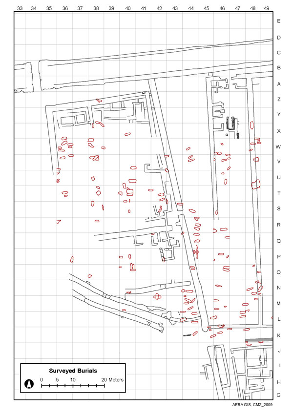
In this detail of the main excavation area, the Wall of the Crow is at the top. On the left, just below the wall, is a large building yet to be excavated. The red marks indicate some of the hundreds of Late Period burials the team has excavated and recorded. The Egyptian field school students are learning important skills digging these burials
The slightly curving walls just above the scale form a curious structure called the Chute. AERA archaeologists are excavating this to determine its function and whether it is contemporary with the enclosure wall (extending from the Wall of the Crow to just beyond the end of the Chute) of the main settlement.
The spring sun is already challenging during midday out in the treeless sands and heat-reflecting rock of the Giza Plateau. It’s challenging at our hotel as well, where they see no need to make the air conditioning operable since by Egyptian standards (and by the calendar) it’s still winter. It was 29C (84.2F) in my room yesterday.
When I arrived, the Cairene atmosphere was full of dust, which gets into everything and irritates the eyes and sinuses. It settles on my keyboard and covers my fingertips as I type this, defying my efforts to keep the computer dusted. It’s the season of the Khamsin (Arabic for “fifty”) named for the fifty days of potential dust storms from mid-March through April.
But unlike the hardworking archaeologists, I’m not bending my back all day nor moving bags of dirt like the Egyptian workers do all day. I’m only wandering around pestering archaeologists with questions and taking their pictures. And trying to get oriented.
Brian Hunt
