By Farrah L. Brown (GIS Specialist) and Brian V. Hunt
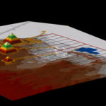
ArcScene view of the Giza Plateau.
The size of AERA’s excavation at Giza’s ancient Egyptian settlement and the enormous quantity of data that it has produced could easily overwhelm. That’s why we’re employing an exciting tool—a Geographic Information System (GIS)—to aid our search to understand the processes and infrastructure that supported pyramid building at Giza.
A major goal for AERA specialists over the next few years is to publish the results of our analysis of more than fifteen years of excavation at Giza. We will offer the methodological and data-analysis of the Giza Plateau Mapping Project (GPMP) in a number of forms: in monographs, in journal articles, and on this web site. GIS will help accomplish this goal.
What is GIS?
GIS is a combination of computer hardware and software designed to store, retrieve and analyze data for which location is an important characteristic. The location information allows us to graphically map the data and view relationships to other data. Typically, we use GIS to:
- Input and store data
- Retrieve data
- Manipulate, map, and analyze data
- Create new data and reports
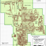
Displaying the digitized 1:100 maps in GIS.
GIS differs from the computer-aided design (CAD) and mapping tools developed during the mid-1980s. The data representation is similar, using spatial objects like points, lines, and areas, but these objects are more than just a digital representation of a paper map. GIS integrates the location and the characteristics of those objects.
GIS provides many choices not possible with conventional mapping by giving us a real-time view of an integrated data source that includes spatial objects, tables, imagery, photographs, as well as links to documents and other related information.
The potential for spatial analysis at Giza
We are involved with a remarkable archaeological project, with data that has much potential for spatial analysis. We are also faced with a huge challenge.
Before we can expect results from the many possible analyses offered by GIS technology, we must address three key elements for each archaeological feature, artifact, or component of architecture to be represented in the GIS: spatial location, attribute data, and relationships to other objects.
Spatial location and attribute data
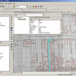
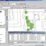
Displaying attribute data of a selected object in ArcMap.
Every object in a GIS must be correctly located in space using precise geographical coordinates, and its nature accurately described by way of attribute data.
Geographic coordinates for each feature are recorded during excavation using survey equipment and discernible locations on the excavation survey grid. Attributes, in our case, are data describing the excavated and unexcavated archaeological materials.
Archaeologists depict attributes in drawings and document them on the various excavation forms. The data that the various specialists create during analyses is also a type of attribute that we will link to spatial objects in the GPMP GIS.
Topology
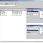
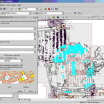
Displaying the GPMP Features dataset and typology in ArcCatalog.
Context is everything in archaeology. The spatial relationships of an archaeological feature, artifact, or architectural component to its surroundings are essential to our research.
In a GIS, management of these relationships is possible due to “topology,” or rules of behavior, which can be established and validated using tools in ESRI’s ArcGIS software. These rules impose restrictions on the placement of objects within the GIS and govern such spatial characteristics as overlap, containment, contiguity, and exclusion.
It’s these properties of attribute data and topology, which describe an object’s characteristics and spatial relationships, that set geographical data apart from other types of information stored in databases.
Asking questions
Ultimately we want to answer questions with our data using GIS.
- What is it?
- Where is it?
- What is its relation to other objects?
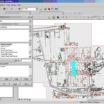
Selecting all lines labeled Gallery Example from a digitized layer.
What is it?
Object-type questions are answered in a GIS by selecting objects based on specific attributes. These operations can include one or more objects and objects with more than one attribute.
For example, in our analysis of the Giza data, we might be interested in identifying the locations of all mud brick walls or all Late Period burials. We could easily select and view these locations if, in the attribute table, the digitized walls are described by type and the burials described by time period.
Where is it?
When we analyze the locations of objects, we can use operations involving Euclidean distances (the “ordinary” distance between the two points that one would measure with a ruler) or descriptions of location. We can create buffers to select objects within a certain distance of other objects with specific characteristics.
For example, at Giza, we might be interested in Late Period burials but only those that are within 30 meters of a mud brick wall. Again, this would be a simple operation in the GPMP GIS. Using a tool in ArcGIS, we could create a 30 meter buffer around all walls labeled “mud brick,” within which all burials labeled “Late Period” would be selected.
What is its relation to other objects?
In a GIS, we use topology to answer questions about the relationships between objects. We can establish rules to govern object placement in the GIS with statements such as: “objects of type A must be contained within objects of type B.”
Analysis based on topology becomes especially important when two archaeological features share a common boundary. It is important, in this case, to eliminate any gaps between the two spatial objects so that analyses will return correct results.
In our case, we might be interested in mud brick walls that are abutted by a certain type of soil, the soil types that surround the Wall of the Crow, or sealings that are contained within certain types of features.
We can combine any or all of these three types of spatial analyses involving object type, location, or relationship for a more complex analysis. For example, we might be interested in the locations of Late Period burials that are within 30 meters of mud brick walls that are 2 meters or taller that are abutted by dark, compact soils that contain sealings with markings related to the period of Menkaure.
What can GIS do for archaeologists?
The capabilities of GIS will provide great benefits for analysis and management of the important archaeological and World Heritage site at Giza. The tools available with ArcGIS will enable archaeologists at Giza to:
- Organize existing data, promote data consistency, and facilitate accurate data entry and data collection.
- Integrate different data formats into one central data store.
- Provide easy access to data sources and user-friendly mapping tools for team members.
- Visualize the archaeology and modern landscape of the Giza Plateau in 2D and 3D.
- Explore distributions and densities of specific artifact, feature, and architectural types.
- Analyze artifact groups and their relationships to possible activity.
- Document and manage environmental impacts and modern-day threats to the site.
The Archaeological community
Sharing ideas about problems and issues that are specific to archaeological GIS is a key to the success of the GPMP GIS and to the contribution of best practices for GIS in archaeology.
We had the privilege of hosting ESRI developer, Tim Hodson, for a tour of the Giza site, where we also had a chance to discuss several data issues with him.
We also attended ESRI’s July 2005 International Users Conference in San Diego, California where we had the opportunity to attend technical workshops, presentations, and the Archaeology and Historic Preservation Special Interest Group Meeting.
The GPMP GIS team will continue to build relationships with other GIS professionals, exchange information on similar datasets and problems, and contribute to the design of a flexible data model that is suitable for use on a wide variety of archaeological excavations.
Conclusion
GIS is a powerful tool that will open doors to an entirely new aspect of analysis for archaeological exploration at Giza. GIS will allow us to implement a data model that is specific to our data management and analysis needs.
We’ve already made considerable progress in the initial months of GIS development. Our efforts to understand the GPMP dataset and to construct a digital base map for the excavation have been a success.
We are currently working diligently to explore the extensive archive of excavation data, organize and check thousands of drawings, integrate multiple specialist databases, and link the GIS to an existing online excavation database.
We’re also in the process of designing and constructing a series of geo-databases in the GIS to house and enable analysis of all of the data collected at Giza.
Our involvement in the larger GIS community will be a catalyst to our efforts, and we hope that our contribution of methods and data-analysis results will be a positive influence on the use of GIS in archaeological investigations.

