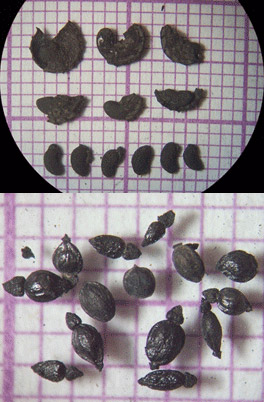
Since 1988 Ancient Egypt Research Associates has systematically collected sediment samples for flotation in order to recover macrobotanical remains from project excavations in Old Kingdom settlements on the low desert to the southeast of the Giza Plateau, Egypt. The goal has been to contribute information on ancient plant use to the project research. This dataset contains all samples studied between 1988–2018. Site conditions at Heit el-Ghurab fluctuate between wet and dry (and have done so for millennia), and therefore only charred plant remains are preserved. Despite the drier conditions of the Khentkawes Town, only charred remains are preserved there as well.
The remains come primarily from two different settlement sites—the Khentkawes Town and Heit el-Ghurab. Within the Heit el-Ghurab settlement there are three distinctly different neighborhoods—the Western Town (large dwellings), the Eastern Town (small village-like dwellings), and the Galleries (a walled area possibly designated for communal accommodation for work and expedition crews). The Khentkawes Town was initially constructed to house priests attached to the funerary cult, but later was probably re-purposed. Information about archaeological features varies for different areas of excavation due to evolving standards of site recording over 30 years.
Dr. Wilma Wetterstrom initiated botanical work at the site. In 1995 the project expanded and Dr. Mary Anne Murray took over. In 2007 Claire Malleson joined as assistant, and in 2012 took over as lead botanist. Trainees have included Mennat-Allah El Dorry, Rebab el-Gendy and Essam Ahmed Soliman.
The Giza Botanical Database project was designed to make this data publicly available for the first time. The work conducted between July 2017–June 2018 focused on data “cleaning.” It included the following:
- Human errors in the database were corrected via a cross-check with the AERA site database (for example, obvious misread/miswritten and mistyped feature or bag numbers, such as “0” instead of “6,” “1” instead of “7”).
- Area codes that had been updated in post-excavation work were corrected based on cross-checks with AERA site database and AERA GIS. This document provides a summary description of areas as well bibliographic references.
- Feature information was updated using the AERA database and the AERA GIS.
- The format of the unique ID for samples (the Master_Sample_Number) was made consistent throughout.
- All botanical identifications were corrected based on updated information. For example, where we had grouped similar unknown items (for example “Trifolieae type A/B/C or D”) when we first encountered them, we later successfully identified these items, but had not necessarily updated the database. In these instances the database was corrected to show the correct identification).
- Botanical terms were updated to reflect accepted international changes in nomenclature/taxonomy (for example, Graminae became Poaceae, Leguminoseae became Fabaceae). It was decided to retain the older names in the records due to the fact that not all student / trainee archaeobotanists are aware of, or familiar with these changes. Some archaeobotanists prefer to retain the older terminologies.
- Field notebooks were cross-checked with the database; corrections were made, and any missing samples were added.
- In addition, the archive (all field notes of flotation and identifications) was updated and stored as hard copies in Boston and Giza, and as digital copies on the AERA server and a dedicated external hard drive.
