Posted by Yasser Mahmoud
We were excited to begin drawing Standing Wall Island’s “jumble of limestone and mud brick walls” (SWI) (see Simon Davis’ “Standing Wall Island” blog post). In the beginning we couldn’t believe ourselves to be honest, because this is the first time for the Egyptian drawing team to draw such extensive walls, containing thousands of pieces of limestone and other cultural material.

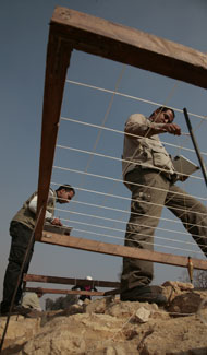
Drawing Team at work on fieldstone wall (photo by Hillary McDonald)

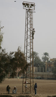
Yasser Mahmoud on a light tower to take and aerial photo of SWI (photo by Hillary McDonald)
The difficulty in drawing this type of structure lies in the position of the stones, because they are located at many different levels and are interwoven with each other. Creating an accurate map is very difficult. After a week, however, I can say that we can now teach the others team members how to approach this type exercise, and accurately map the walls.
One such method is to use a wooden planning frame (a meter-square) that is subdivided with nylon string into10 or 20 cm squares, thus dividing the planning frame into 100 or 25 segments. The planning frame must be laid horizontally on the ground and we use the rocks to prop up the frame, until the planning frame is level.
In addition we use wooden rulers and pencils (with at least 1H leads) or automatic or clutch pencils to record our evidence. We also use similar method to draw section of the archaeological strata or the elevations of the walls; you just put the drawing frame against the wall.
It’s tricky at SWI because at some stage the walls had collapsed, spreading stone everywhere and making it almost impossible to separate the actual wall from the fallen structure. So far we have finished the section elevations and the plan of the western wall, the northern wall, the eastern walls and the southern wall, which was only this season discovered.

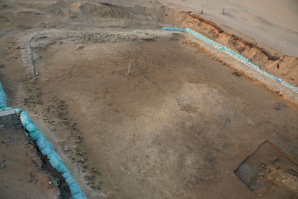
Southern Area of SWI from a Light tower (photo by Yasser Mahmoud)
