Online Data
We are committed to fully archiving all our records and eventually making our data archives available to the global public through online platforms.
Our online data collections available to date include the ARCE Sphinx Project and the Giza Botanical database.
The ARCE Sphinx Project (1979-1983) Online Data Archive
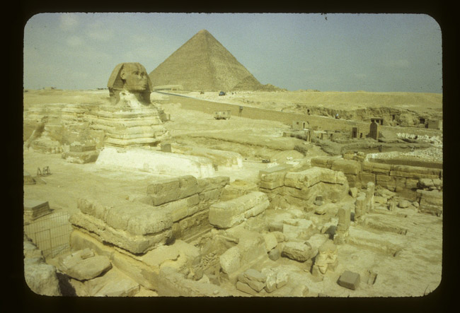
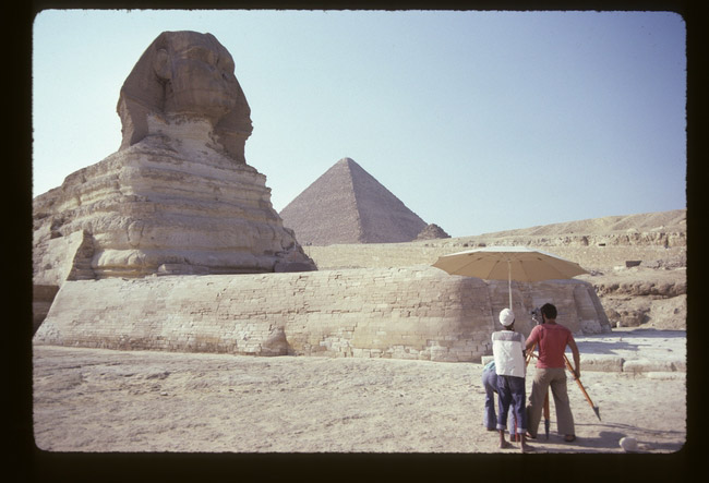
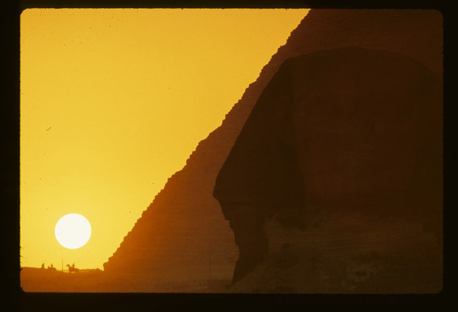
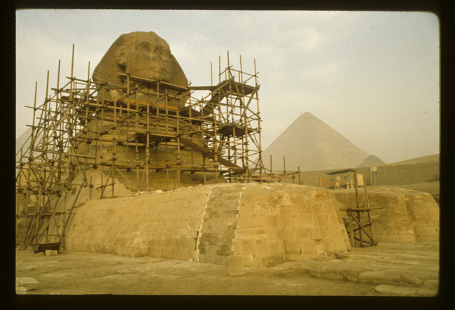
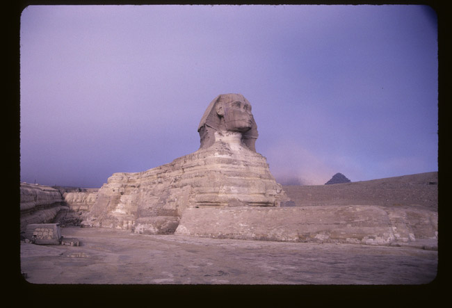
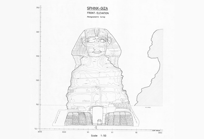
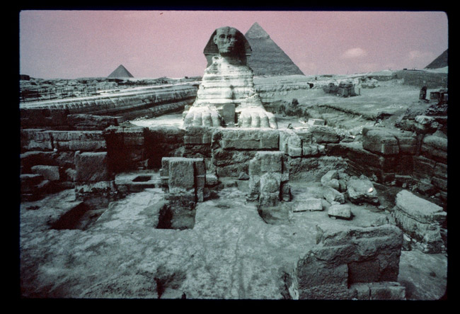
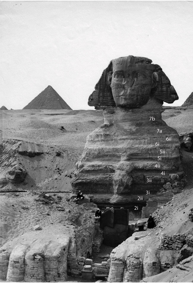
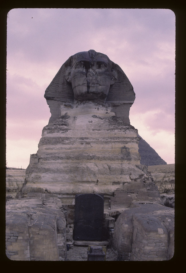
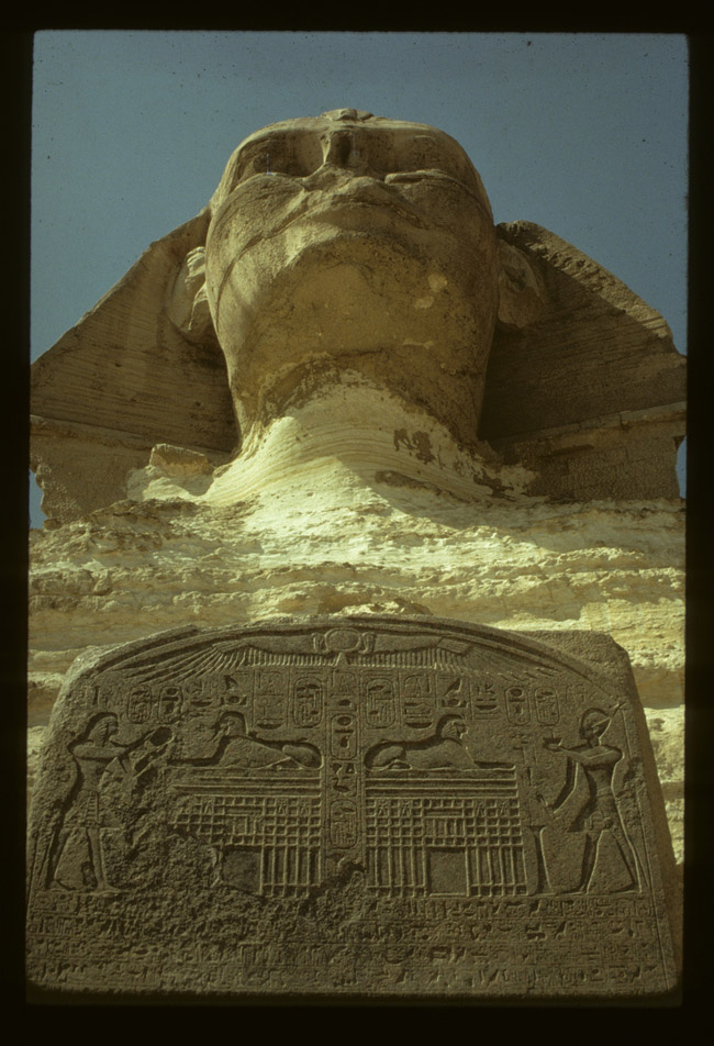
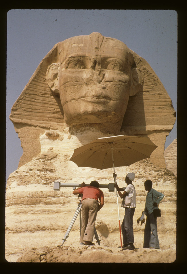
 The American Research Center in Egypt Sphinx Project (1979-1983) aimed to produce scale drawings (plans and elevations) of the Great Sphinx of Giza, where no scale drawings of this unique monument had been produced before, to map the greater Sphinx site, including three ancient Egyptian temples situated east of the statue, and the larger quarry forming the Sphinx “amphitheater.” Objectives included elevations, profiles, and a detailed master plan of the Sphinx, detailed section and profile drawings showing the masonry restorations added to the statue, topographical maps of the Sphinx ditch and larger quarry, and maps of the structural geology of the site, showing stratification and faults.
The idea was that we could achieve a better understanding of the origin of the Sphinx and how the 4th Dynasty Egyptians created the Sphinx from careful, recorded observations of its structure and geology, and that a good part of the history of the Sphinx could be read from detailed survey and mapping of the stratified masonry on the Sphinx, and from the condition of the bedrock core under the earliest masonry, as well as from analysis of tool marks and mortar bonding the different phases.
Thanks to a grant from the American Research Center in Egypt (ARCE), in 2016 we began a new project to digitize the entire original Sphinx archive, both to preserve the data and to make it freely available to other researchers worldwide. A brief overview and an in-depth report on both Sphinx projects are available on the ARCE website.
The Sphinx Project data archive is now available at Open Context. The online data includes written, drawn, and color slide photographs and black and white photographs. Drawings include:
- Master elevations of the front and sides of the Sphinx, scale 1:50,
- Master plan of the Sphinx, scale 1:50,
- Detailed maps of the 4th Dynasty Khafre Valley Temple, the Sphinx Temple, and the 18th Dynasty Amenhotep II Temple, scale 1:100,
- Topographical and geological maps of the wider Sphinx “amphitheater,” scale 1:200,
- 1:1,000 map of the Sphinx and modern installations to the East as of 1979,
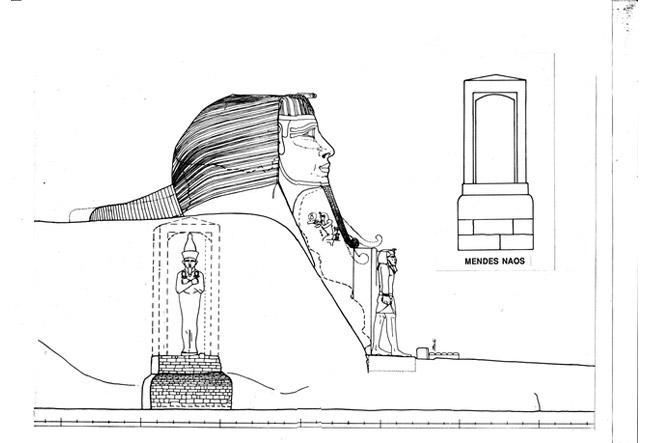
- Detailed architectural sections and elevations of the stratified ancient masonry layers applied to the Sphinx bedrock core body, scale 1:20 and 1:10,
- 5,000 slides,
- 2,716 black and white photographs,
- Profile of the Sphinx area with water table measurements taken during 1981-82.
Click here to find out more about the ARCE Sphinx Project Archive on Open Context.
Click here to start browsing the Sphinx online data.
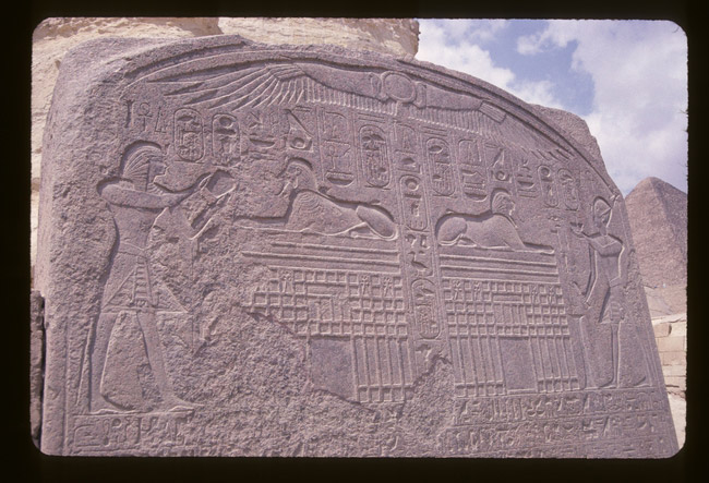
Selected images from the ARCE Sphinx Project Archive:


The Giza Botanical Database Project
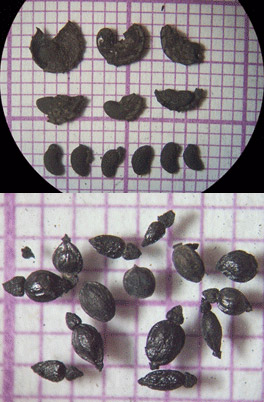 Since 1988 Ancient Egypt Research Associates has systematically collected sediment samples for flotation in order to recover macrobotanical remains from project excavations in Old Kingdom settlements on the low desert to the southeast of the Giza Plateau, Egypt. The goal has been to contribute information on ancient plant use to the project research. This dataset contains all samples studied between 1988–2018. Site conditions at Heit el-Ghurab fluctuate between wet and dry (and have done so for millennia), and therefore only charred plant remains are preserved. Despite the drier conditions of the Khentkawes Town, only charred remains are preserved there as well.
The remains come primarily from two different settlement sites—the Khentkawes Town and Heit el-Ghurab. Within the Heit el-Ghurab settlement there are three distinctly different neighborhoods—the Western Town (large dwellings), the Eastern Town (small village-like dwellings), and the Galleries (a walled area possibly designated for communal accommodation for work and expedition crews). The Khentkawes Town was initially constructed to house priests attached to the funerary cult, but later was probably re-purposed. Information about archaeological features varies for different areas of excavation due to evolving standards of site recording over 30 years.
Dr. Wilma Wetterstrom initiated botanical work at the site. In 1995 the project expanded and Dr. Mary Anne Murray took over. In 2007 Dr. Claire Malleson joined as assistant, and in 2012 took over as lead botanist. Trainees have included Mennat-Allah El Dorry, Rebab el-Gendy and Essam Ahmed Soliman.
In 2017, Dr. Malleson received an American Research Center in Egypt (ARCE) Archaeological Endowment Fund Grant which allowed her to focus on “cleaning” the data and preparing it for publication.